![](/images/other/stat-length.png)
![Percorso A piedi Schwäbisch Gmünd - SAV OG Lindach Rundwanderweg C - Photo](https://media.geolcdn.com/t/1900/400/ext.pjpeg?maxdim=2&url=https%3A%2F%2Fmedia.geolcdn.com%2Ff%2F6c4e10e7-55dc-402a-a995-42ad31328437.jpeg)
SAV OG Lindach Rundwanderweg C
SityTrail - itinéraires balisés pédestres
Tous les sentiers balisés d’Europe PRO
![Lunghezza](/images/other/stat-length.png)
Lunghezza
10 km
![Altitudine massima](https://static1.geolcdn.com/siteimages/upload/files/1508320355ic_sort_altitude_max_24dp.png)
Altitudine massima
482 m
![Dislivello positivo](https://static1.geolcdn.com/siteimages/upload/files/1508320355ic_sort_den_pos_24dp.png)
Dislivello positivo
159 m
![Km-Effort](/images/other/stat-length.png)
Km-Effort
12,2 km
![Altitudine minima](https://static1.geolcdn.com/siteimages/upload/files/1508320355ic_sort_altitude_min_24dp.png)
Altitudine minima
375 m
![Dislivello negativo](https://static1.geolcdn.com/siteimages/upload/files/1508320355ic_sort_den_neg_24dp.png)
Dislivello negativo
171 m
![Boucle](https://static1.geolcdn.com/siteimages/upload/files/16400158638029165_repeat_loop_refresh_sync_direction_icon.png)
Boucle
Sì
Tag
Data di creazione :
2022-02-11 15:29:31.918
Ultima modifica :
2022-02-11 15:29:31.918
![A piedi](https://static1.geolcdn.com/sitytour/trail-icons/100.png)
2h46
Difficoltà : Facile
![Scannerizza questo codice QR per aprire il percorso nell'applicazione SityTrail](https://capi.geolives.com/qq0zvz2zws4bq2lad0pu/sitytour/trails/3094596/qr.png?size=200)
Applicazione GPS da escursionismo GRATUITA
Chi siamo
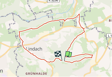
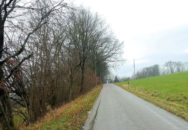
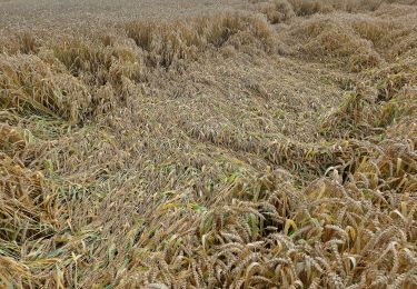
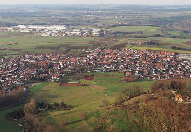
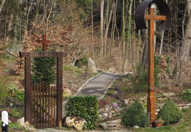
Percorso A piedi di 10 km da scoprire a Baden-Württemberg, Ostalbkreis, Schwäbisch Gmünd. Questo percorso è proposto da SityTrail - itinéraires balisés pédestres.
Descrizione
Trail created by Schwäbischer Albverein OG Lindach.
Symbol: Schwarzes C auf weißem Grund
Localizzazione
Paese:
Germany
Regione :
Baden-Württemberg
Dipartimento/Provincia :
Ostalbkreis
Comune :
Schwäbisch Gmünd
Località :
Unknown
Partenza:(Dec)
Partenza:(UTM)
561250 ; 5408401 (32U) N.
Commenti
Percorsi nelle vicinanze
![Percorso A piedi Schwäbisch Gmünd - Ottenried - Schwäbisch Gmünd - Photo](https://media.geolcdn.com/t/375/260/ext.jpg?maxdim=2&url=https%3A%2F%2Fmedia.geolcdn.com%2Ff%2F32c898d1-cc88-4c39-a55b-f78d3cd0a21c.jpeg)
![A piedi A piedi](https://static1.geolcdn.com/sitytour/trail-icons/100.png)
Ottenried - Schwäbisch Gmünd
A piedi
Medio
Schwäbisch Gmünd,
Baden-Württemberg,
Ostalbkreis,
Germany
![](/images/other/stat-length.png)
22 km | 27 km-effort
6h 10min
![](https://static1.geolcdn.com/siteimages/upload/files/16400158638029165_repeat_loop_refresh_sync_direction_icon.png)
No
![Percorso A piedi Schwäbisch Gmünd - Schwäbisch Gmünd-Alfdorf-Welzheim... - Photo](https://media.geolcdn.com/t/375/260/ext.jpg?maxdim=2&url=https%3A%2F%2Fmedia.geolcdn.com%2Ff%2Fbaa5a369-091a-4d3c-9d19-a5237606c41f.jpeg)
![A piedi A piedi](https://static1.geolcdn.com/sitytour/trail-icons/100.png)
Schwäbisch Gmünd-Alfdorf-Welzheim...
A piedi
Facile
Schwäbisch Gmünd,
Baden-Württemberg,
Ostalbkreis,
Germany
![](/images/other/stat-length.png)
11,2 km | 15,8 km-effort
3h 35min
![](https://static1.geolcdn.com/siteimages/upload/files/16400158638029165_repeat_loop_refresh_sync_direction_icon.png)
No
![Percorso A piedi Mutlangen - Mutlangen Rundwanderweg 4 - Photo](https://media.geolcdn.com/t/375/260/ext.jpg?maxdim=2&url=https%3A%2F%2Fmedia.geolcdn.com%2Ff%2F6a300192-1a6b-4553-9fa5-cf95796e6955.jpeg)
![A piedi A piedi](https://static1.geolcdn.com/sitytour/trail-icons/100.png)
Mutlangen Rundwanderweg 4
A piedi
Facile
Mutlangen,
Baden-Württemberg,
Ostalbkreis,
Germany
![](/images/other/stat-length.png)
8,6 km | 10,6 km-effort
2h 24min
![](https://static1.geolcdn.com/siteimages/upload/files/16400158638029165_repeat_loop_refresh_sync_direction_icon.png)
Sì
![Percorso A piedi Schwäbisch Gmünd - Glaubensweg 7 - Photo](https://media.geolcdn.com/t/375/260/ext.jpg?maxdim=2&url=https%3A%2F%2Fmedia.geolcdn.com%2Ff%2Fe58a1fe9-5ab1-4b6a-a440-f7a044a9d60d.jpeg)
![A piedi A piedi](https://static1.geolcdn.com/sitytour/trail-icons/100.png)
Glaubensweg 7
A piedi
Facile
Schwäbisch Gmünd,
Baden-Württemberg,
Ostalbkreis,
Germany
![](/images/other/stat-length.png)
3,4 km | 4,3 km-effort
58min
![](https://static1.geolcdn.com/siteimages/upload/files/16400158638029165_repeat_loop_refresh_sync_direction_icon.png)
No
![Percorso A piedi Schwäbisch Gmünd - Glaubensweg 9 - Photo](https://media.geolcdn.com/t/375/260/ext.jpg?maxdim=2&url=https%3A%2F%2Fmedia.geolcdn.com%2Ff%2Fe26ba072-2ef6-4be7-acef-b7ca1a27eb29.jpeg)
![A piedi A piedi](https://static1.geolcdn.com/sitytour/trail-icons/100.png)
Glaubensweg 9
A piedi
Facile
Schwäbisch Gmünd,
Baden-Württemberg,
Ostalbkreis,
Germany
![](/images/other/stat-length.png)
7,5 km | 11,4 km-effort
2h 35min
![](https://static1.geolcdn.com/siteimages/upload/files/16400158638029165_repeat_loop_refresh_sync_direction_icon.png)
No
![Percorso A piedi Iggingen - Östlich von Iggingen mit Blick auf die Alb - Photo](https://media.geolcdn.com/t/375/260/ext.jpg?maxdim=2&url=https%3A%2F%2Fmedia.geolcdn.com%2Ff%2Fca43b3a5-46ea-4854-95bd-63c14f630a3e.jpeg)
![A piedi A piedi](https://static1.geolcdn.com/sitytour/trail-icons/100.png)
Östlich von Iggingen mit Blick auf die Alb
A piedi
Facile
Iggingen,
Baden-Württemberg,
Ostalbkreis,
Germany
![](/images/other/stat-length.png)
6,2 km | 7,8 km-effort
1h 46min
![](https://static1.geolcdn.com/siteimages/upload/files/16400158638029165_repeat_loop_refresh_sync_direction_icon.png)
Sì
![Percorso A piedi Iggingen - Südlich von Iggingen mit Limesabschnitt - Photo](https://media.geolcdn.com/t/375/260/ext.jpg?maxdim=2&url=https%3A%2F%2Fmedia.geolcdn.com%2Ff%2Fca43b3a5-46ea-4854-95bd-63c14f630a3e.jpeg)
![A piedi A piedi](https://static1.geolcdn.com/sitytour/trail-icons/100.png)
Südlich von Iggingen mit Limesabschnitt
A piedi
Facile
Iggingen,
Baden-Württemberg,
Ostalbkreis,
Germany
![](/images/other/stat-length.png)
4,8 km | 6,1 km-effort
1h 23min
![](https://static1.geolcdn.com/siteimages/upload/files/16400158638029165_repeat_loop_refresh_sync_direction_icon.png)
Sì
![Percorso A piedi Schwäbisch Gmünd - Igginger Wanderweg 1 - Photo](https://media.geolcdn.com/t/375/260/ext.jpg?maxdim=2&url=https%3A%2F%2Fmedia.geolcdn.com%2Ff%2Fb321e46e-5d3e-4161-84f1-cdf56d3218cf.jpeg)
![A piedi A piedi](https://static1.geolcdn.com/sitytour/trail-icons/100.png)
Igginger Wanderweg 1
A piedi
Facile
Schwäbisch Gmünd,
Baden-Württemberg,
Ostalbkreis,
Germany
![](/images/other/stat-length.png)
6,7 km | 7,6 km-effort
1h 43min
![](https://static1.geolcdn.com/siteimages/upload/files/16400158638029165_repeat_loop_refresh_sync_direction_icon.png)
Sì
![Percorso A piedi Mutlangen - Mutlanger Rundwanderweg 2 - Photo](https://media.geolcdn.com/t/375/260/ext.jpg?maxdim=2&url=https%3A%2F%2Fmedia.geolcdn.com%2Ff%2F92f2b4f8-c15d-40e2-b829-8c17c0ce3c95.jpeg)
![A piedi A piedi](https://static1.geolcdn.com/sitytour/trail-icons/100.png)
Mutlanger Rundwanderweg 2
A piedi
Facile
Mutlangen,
Baden-Württemberg,
Ostalbkreis,
Germany
![](/images/other/stat-length.png)
6 km | 7,4 km-effort
1h 41min
![](https://static1.geolcdn.com/siteimages/upload/files/16400158638029165_repeat_loop_refresh_sync_direction_icon.png)
No